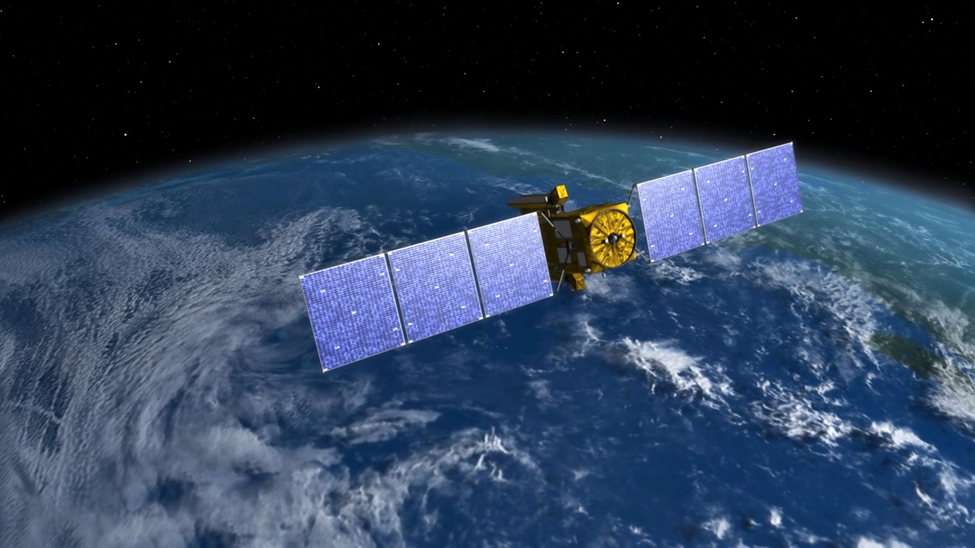
Designed to make the first-ever global survey of Earth’s surface water, the Surface Water and Ocean Topography, or SWOT, satellite will collect detailed measurements of how water bodies on Earth change over time. Credit: NASA/JPL-CaltechThe SWOT satellite, a collaborative effort between NASA and CNES, is revolutionizing flood prediction by providing comprehensive data on water heights across nearly all water surfaces on Earth.Rivers, lakes, and reservoirs act like our planet’s arteries, carrying life-sustaining water through vast interconnected networks. When Earth’s water cycle runs too fast, flooding can result, endangering lives and property. That risk is increasing as climate change alters precipitation patterns and more people are living in flood-prone areas worldwide.Scientists and water managers use many types of data to predict flooding. This year they have a new tool at their disposal: freshwater data from the Surface Water and Ocean Topography (SWOT) satellite. The observatory, a collaboration between NASA and the French space agency, CNES (Centre National d’Études Spatiales), is measuring the height of nearly all water surfaces on Earth. SWOT was designed to measure every major river wider than about 300 feet (100 meters), and preliminary results suggest it may be able to observe much smaller rivers.Flooding on the Souris River inundated this community in North Dakota in 2011. The U.S.-French SWOT satellite is giving scientists and water managers a new tool to look at floods in 3D, information that can improve predictions of where and how often flooding will occur. Credit: North Dakota State Water CommissionStream gauges can accurately measure water levels in rivers, but only at individual locations, often spaced far apart. Many rivers have no stream gauges at all, particularly in countries without resources to maintain and monitor them. Gauges can also be disabled by floods and are unreliable when water overtops the riverbank and flows into areas they cannot measure.SWOT provides a more comprehensive, 3D look at floods, measuring their height, width, and slope. Scientists can use this data to better track how floodwaters pulse across a landscape, improving predictions of where flooding will occur and how often.Flooding from monsoon rains covers a wide region of northeast Bangladesh in this October 8, 2023, image showing data from SWOT. The U.S.-French satellite is the first to provide timely, precise water surface elevation information over entire regions at high resolution, enabling improved flooding forecasts. Credit: NASA/JPL-Caltech/UNC-Chapel Hill/Google EarthBuilding a Better Flood ModelOne effort to incorporate SWOT data into flood models is led by J. Toby Minear of the Cooperative Institute for Research in Environmental Sciences (CIRES) in Boulder, Colorado. Minear is investigating how to incorporate SWOT data into the National Oceanic and Atmospheric Administration’s National Water Model, which predicts the potential for flooding and its timing along U.S. rivers. SWOT freshwater data will fill in spatial gaps between gauges and help scientists like Minear determine the water levels (heights) at which flooding occurs at specific locations along rivers.SWOT river slope data — like that depicted here for California’s Sacramento River — can improve predictions of how fast water flows through rivers and off landscapes. To calculate slope, scientists subtract the lower water elevation (right) from the higher one (left) and divide by segment length. Credit: NASA/JPL-Caltech/UNC-Chapel Hill/Google EarthHe expects SWOT to improve National Water Model data in multiple ways. For example, it will provide more accurate estimates of river slopes and how they change with streamflow. Generally speaking, the steeper a river’s slope, the faster its water flows. Hydrologic modelers use slope data to predict the speed water moves through a river and off a landscape.SWOT will also help scientists and water managers quantify how much water lakes and reservoirs can store. While there are about 90,000 relatively large U.S. reservoirs, only a few thousand of them have water-level data that’s incorporated into the National Water Model. This limits scientists’ ability to know how reservoir levels relate to surrounding land elevations and potential flooding. SWOT is measuring tens of thousands of U.S. reservoirs, along with nearly all natural U.S. lakes larger than about two football fields combined.Some countries, including the U.S., have made significant investments in river gauging networks and detailed local flood models. But in Africa, South Asia, parts of South America, and the Arctic, there’s little data for lakes and rivers. In such places, flood risk assessments often rely on rough estimates. Part of SWOT’s potential is that it will allow hydrologists to fill these gaps, providing information on where water is stored on landscapes and how much is flowing through rivers.UNC-Chapel Hill doctoral student Marissa Hughes levels a tripod to install a GPS unit to precisely measure the water surface elevation of a segment of New Zealand’s Waimakariri River. The measurements were used to calibrate and validate data from the U.S.-French SWOT satellite. Credit: Alyssa LaFaro/UNC ResearchTamlin Pavelsky, NASA’s SWOT freshwater science lead and a researcher at the University of North Carolina at Chapel Hill, says SWOT can help address the growing threat of flooding from extreme storms fueled by climate change. “Think about Houston and Hurricane Harvey in 2017,” he said. “It’s very unlikely we would have seen 60 inches of rain from one storm without climate change. Societies will need to update engineering design standards and floodplain maps as intense precipitation events become more common.”Pavelsky says these changes in Earth’s water cycle are altering society’s assumptions about floods and what a floodplain is. “Hundreds of millions of people worldwide will be at increased risk of flooding in the future as rainfall events become increasingly intense and population growth occurs in flood-prone areas,” he added.SWOT flood data will have other practical applications. For example, insurers can use models informed by SWOT data to improve flood hazard maps to better estimate an area’s potential damage and loss risks. A major reinsurance company, FM Global, is among SWOT’s 40 current early adopters — a global community of organizations working to incorporate SWOT data into their decision-making activities.“Companies like FM Global and government agencies like the U.S. Federal Emergency Management Agency can fine tune their flood models by comparing them to SWOT data,” Pavelsky said. “Those better models will give us a more accurate picture of where and how often floods are likely to happen.”More About the MissionLaunched on December 16, 2022, from Vandenberg Space Force Base in central California, SWOT is now in its operations phase, collecting data that will be used for research and other purposes.SWOT was jointly developed by NASA and CNES, with contributions from the Canadian Space Agency (CSA) and the UK Space Agency. NASA’s Jet Propulsion Laboratory, managed for the agency by Caltech in Pasadena, California, leads the project’s U.S. component. For the flight system payload, NASA provided the KaRIn instrument, a GPS science receiver, a laser retroreflector, a two-beam microwave radiometer, and NASA instrument operations. CNES provided the Doppler Orbitography and Radioposition Integrated by Satellite (DORIS) system, dual frequency Poseidon altimeter (developed by Thales Alenia Space), KaRIn radio-frequency subsystem (together with Thales Alenia Space and with support from the UK Space Agency), the satellite platform, and ground operations. CSA provided the KaRIn high-power transmitter assembly. NASA provided the launch vehicle and the agency’s Launch Services Program, based at Kennedy Space Center, and managed the associated launch services.
How SWOT Transforms Flood Forecasting


