A series of upper-level disturbances has delivered rounds of wintry weather to the high elevations of the central and northern Rockies, despite the calendar heading into late May. From NWS Weather Prediction Center (WPC) in the AM of 5/21: “cool and unsettled weather underneath a broad upper trough is anticipated to remain locked-in over the Northwest and Rockies through at least midweek. Snow is possible into the higher elevations of Wyoming and Colorado today…High temperatures in these regions are also expected to remain on the cooler side and 10 to 25 degrees below average.” VIIRS Snowmelt RGB imagery valid 1950 UTC 21 May 2024 showed fresh snow cover across the high elevations of western Wyoming and southern Montana with thick ice clouds farther east in northern Wyoming.
Figure 1: VIIRS Snowmelt RGB imagery showing fresh snow cover (fine cyan color) in the circled regions valid 1950 UTC 21 May 2024. From CIRA Slider
On 22 May 2024, a separate upper-level low pushed into the Pacific Northwest, leading to more unsettled weather. The GOES-East Day Cloud Phase Distinction RGB offered another unique view of the snow cover in Colorado and Wyoming, represented by the bright green colors. In the animation, you can also see the spinning area of low pressure in eastern Washington with convection occurring to the east, represented by the yellow-green (glaciating) and red-orange (high-level) clouds.
Figure 2: GOES-East Day Cloud Phase Distinction RGB valid ~1600 UTC to ~2000 UTC 22 May 2024. From CIRA Slider
The system slowly pushed east, and on the 1200 UTC 23 May 2024 WPC Surface Analysis, the 999 mb surface low was located in north-central Wyoming.
Figure 3: WPC Surface Analysis valid 1200 UTC 23 May 2024
GOES-East Airmass RGB imagery on 23 May 2024 showed the low pressure inching east, with most of the convection centered over the southern half of Montana. The low pressure was collocated with an elongated piece of dry upper levels and higher levels of potential vorticity (noted by the deep red color), likely caused by an upstream tropopause fold. The higher levels of potential vorticity may have led to the slow intensification of the extratropical cyclone. An explosive area of convection can also be seen across southern Oklahoma in this animation.
Figure 4: GOES-East Airmass RGB imagery valid ~0700 UTC to ~1400 UTC 23 May 2024. From STAR GOES Imagery Viewer
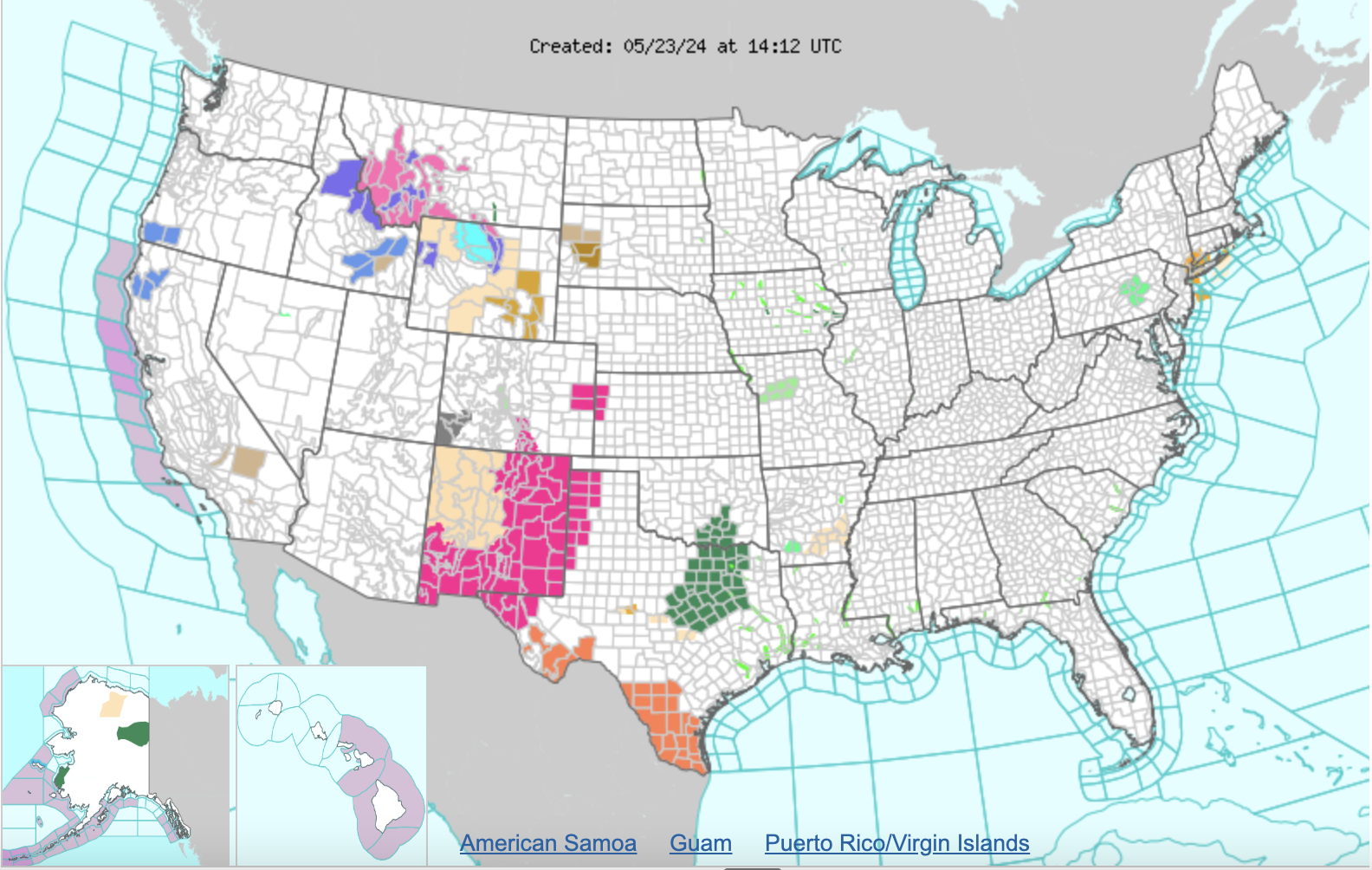
Winter Weather Advisories and Winter Storm Warnings were in effect for parts of Idaho, Montana, and Wyoming on the morning of May 23, with up to two feet of snow possible in the Absaroka/Beartooth Mountains, according to NWS Billings, MT.
Figure 5: NWS alerts in effect across the Continental U.S. valid 1412 UTC 23 May 2023.
Chris Smith, CISESS GOES-R Satellite Liaison for NWS WPC/OPC

